Drone Roof Inspection in Elizabeth, NJ
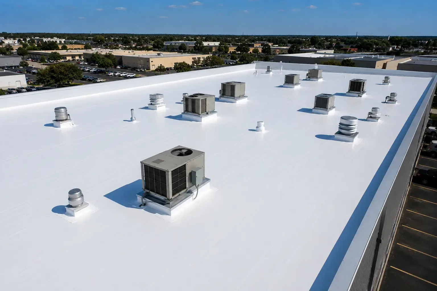
Aerial images show roof areas that are difficult to see from a ladder or hatch. A drone can capture broad fields, perimeter transitions, rooftop equipment, and areas blocked from a direct walking route. We use that view to support an inspection, not replace it. On a large warehouse near the North Avenue corridor, a camera pass can help map seams and equipment before a hands-on review. We still verify suspect conditions on the roof when access is safe and the detail requires touch, probing, or testing.
Drone imaging can be useful for an expansive roof, a steep or obstructed section, or a property where a full walk needs careful planning. The deliverable should connect each image to a location and a next step. We mark visible concerns, note areas the camera could not resolve, and recommend a closer review where surface appearance is not enough to determine condition.
Capture the Roof in a Planned Flight
Before flight, we confirm site access, airspace restrictions, nearby operations, weather, and the area where the aircraft can be launched and recovered. The property contact identifies sensitive equipment, active truck paths, and any roof areas that require a specific approach. Conditions such as wind, rain, glare, and low visibility can limit image quality or safe operation. We reschedule when the conditions do not support a useful capture.
The flight is planned to show roof sections, edges, penetrations, drains, and equipment relationships. A wide image helps orient a property manager; closer frames show a seam, curb, or metal transition that needs attention. Images are labeled by roof area so they can be compared with inspection notes. For a site near Midtown Elizabeth, we also plan launch and recovery away from pedestrian and vehicle activity.
Aerial imaging records what the camera can see from above. It cannot confirm that insulation is dry, that a seam is bonded, or that a deck is sound. Reflections, shadows, dirt, and surface color can hide or imitate defects. We mark those limits and use a hands-on roof inspection to check the details that affect a repair decision.
Turn Images Into Inspection Findings
Photos become useful when they point to a condition and a location. We review the roof by section, note visible punctures, displaced edge metal, open flashing corners, debris at drains, and equipment supports, then identify which areas need direct inspection. A close frame may show a lifted seam edge; only a field check can establish whether it is loose or simply casting a shadow.
Elizabeth’s commercial environment includes warehouse, retail, hotel, and office properties. The roof image set is organized to match the actual building layout, not to suggest that all local roofs share one design. Where the work area sits among loading operations, we can use the images to plan access and identify obstructions before a crew carries tools onto the roof. Airport proximity alone does not determine whether a drone flight is permitted. Before launch, we confirm current airspace restrictions and site-specific permissions for the proposed flight.
For properties near Elizabethport, the report can show the roof sections inspected and the visual concerns requiring a closer check. If the roof has several connected sections, we group images by elevation or zone. This reduces confusion when a property team assigns follow-up work and compares new photographs with an earlier capture.
Pair Aerial Views With Direct Testing
A drone does not measure moisture below a membrane. Infrared imaging may help identify thermal patterns across a broad area, but a suspect location may still need a core cut to confirm wet insulation. We use each method for the question it can answer: aerial images for visible layout and access, direct inspection for seams and flashing, and selective testing for concealed conditions.
If images show a loose edge or open detail, we inspect the attachment and adjacent materials before recommending a repair. A coping and edge-metal review may follow when the perimeter appears displaced. If several areas show staining or surface changes, a moisture survey may be a better next step than treating each mark as a separate repair. We explain the evidence and test limits in the report.
Weather and site conditions can restrict the view. A rooftop screen, parapet, tree, or mechanical unit may block a camera angle. Glare can wash out a membrane surface, while a wet roof may reflect light differently from a dry one. We list those limitations so an owner does not mistake an incomplete view for a clean bill of health.
Use the Images to Plan Roof Work
Drone photographs can help a property manager plan a repair visit, compare roof zones, or brief a maintenance team before access. The image set can identify likely work areas, but the contractor still verifies dimensions and attachment at the roof. If a repair is approved, we define the material, surface preparation, and detail that need to be completed. A commercial roof repair scope should follow confirmed conditions, not an image alone.
For an Elizabeth warehouse or distribution facility, images may help locate equipment and travel paths that shape staging. At a retail property, they can help show perimeter conditions before planning a lift. We coordinate the actual route with the property contact and avoid interrupting operating areas. Images are not a substitute for a fall-protection plan or access controls.
The North Avenue corridor serves port truck traffic, hotels, retail, and warehouses. Aerial review can help orient a roof on a site with busy circulation, while the project plan still relies on the individual property’s access rules. For a building in Elizabethport, the image report stays focused on that roof rather than assumptions about neighboring properties.
Keep a Consistent Roof Image Record
Save the capture date, roof-area labels, inspection notes, and follow-up items together. That record can help a property team compare visible changes after a storm or equipment project. A later image may show that edge metal moved or debris returned to a drain area. It cannot explain when a condition began unless previous records show the same view.
We can combine the aerial record with a condition report that organizes observations and recommended actions. If a leak is active, use a leak investigation to trace water entry and test suspect areas. The right scope depends on whether the concern is visible from above or concealed in the assembly.
After other trades work on a roof, capture new penetrations and service paths in the property file. Tell contractors where fragile details or repaired areas sit, and require flashing around new supports or conduit. This keeps the next inspection tied to the current roof rather than an outdated image set.
Commercial Roofing Questions
Can a drone replace a hands-on inspection?
No. Aerial images help show layout and visible surface conditions, but they cannot test a seam bond, confirm moisture under the membrane, or establish deck condition. We use the images to direct a closer inspection where the roof and access conditions require it.
What roof conditions can the camera show?
The images can show broad surface patterns, debris, visible punctures, displaced metal, equipment placement, and areas that may need a closer look. Shadows, glare, obstructions, and surface reflections can conceal or imitate a concern. We label those limits and verify important details on the roof.
Can you fly over an operating warehouse?
We first review site rules, active vehicle paths, weather, and airspace restrictions. The property contact helps identify safe launch and recovery locations and any sensitive areas. If conditions do not support safe capture, we arrange another time or use a ground-based inspection method.
Will the images tell us whether insulation is wet?
A standard drone image cannot establish moisture below the roof surface. Infrared imaging can identify patterns for further testing, and a core cut can confirm conditions at a specific point. We choose the method based on the question and mark what each result does and does not show.
How does a drone report help plan repairs?
It gives the property team a labeled view of roof zones, visible concerns, and access constraints. We pair that view with Diligence Notes and hands-on findings before writing a repair scope. That way the owner can connect the proposed work to a location and a condition.
Map the Roof Before the Next Work Visit
Share the building type, roof access rules, and areas that need review. We will determine whether aerial imaging can support an inspection and what follow-up testing may be needed.